I am always fond of visiting historical sights in Pakistan. Moreover, I have tried to explore those regions which do not have popular public access because either the people don't know about those places, or the roads leading to such places are either non existent or in a deplorable condition.
Last Year ( Summer 2015), me and my father along with a colleague wanted to go to Nandana Fort. It is basically a small fort located at the top of a sizable mountain in the Salt Range about 20 km onwards from Pind Dadan Khan. We had no idea about the road conditions apart from what info we got from google earth but we set out fro our journey from Rawalpindi at 9 in the morning.
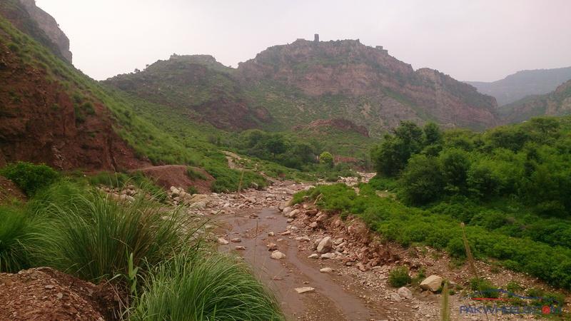
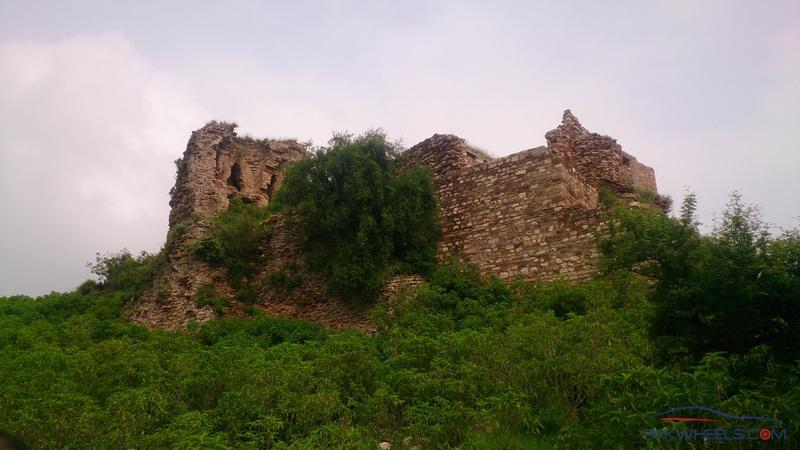
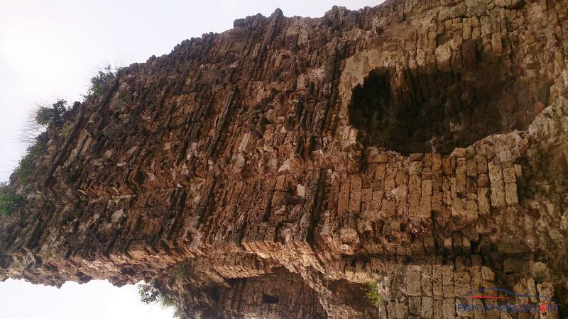
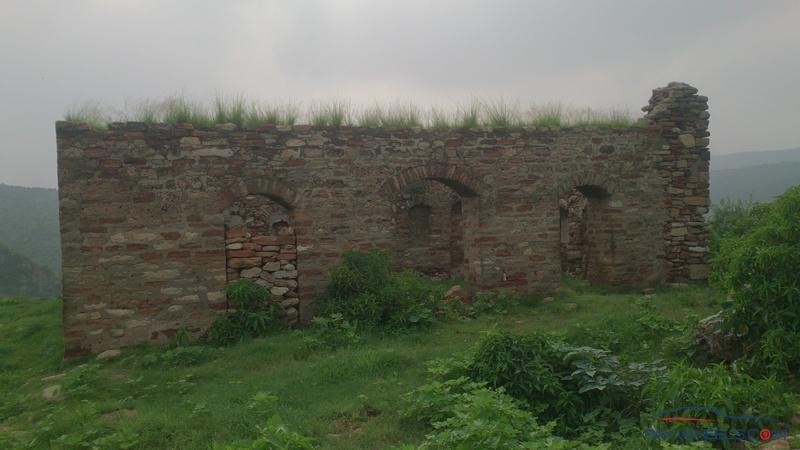
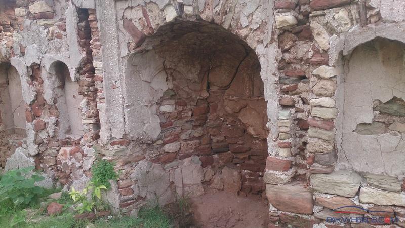
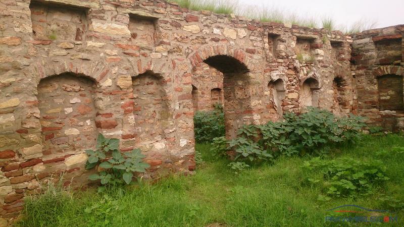
Nandana fort is about 1000 years old, and is also the site from where Al-Beruni ( the famous persian mathematician) made an estimate of the earth's radius in the year ~1100 or so. There are 2 old temples atop the mountain which are still intact and 2 walls of the fort sill in tact along with a mosque at the site, which was most likely built much later ( suggested by it's British era architecture.
Route:
1) from Rawalpindi, we traveled via GT road to Sohawa, from where we took the Sohawa -Chakwal Road. This road is in good condition, some people might consider taking Mandra-Chakwal road to reach chakwal, but that road is being dualized so traffic is slow.
2) about 1 km before reaching chakwal, make a turn towards Choa Saiden Shah. This road is also in great condition, you can easily travel at 70-80 speed on both of these roads apart from curving sections
3) once you reach choa saiden shah, you can take the bypass to go around the city and continue onwards down the salt range towards Khewra,
4) eventually you will reach Khewra, pass through the city and continue onwards to pind dadan khan. From here take a left on the road heading towards jalal pur sharif ( or Jehlum). This road at that time was being re constructed completely, so we had to travel very slowly and most of it was bad, but i assume by now it might have been re constructed.
5) travel about 15-20 km until you reach a small village from which a sizable road branches to a city called " rawaal" you can see this from google earth.
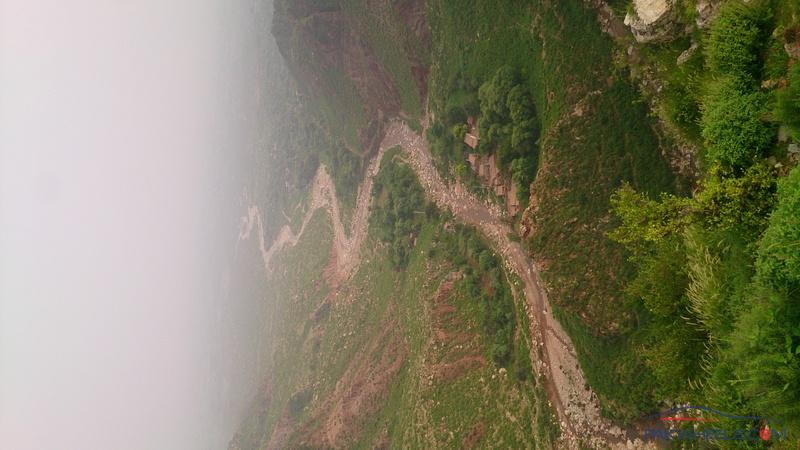
6) after travelling about 6 km on this road to rawaal you can turn on to a local village road whiich heads to baghanwala. This is the tricky part. If you have a jeep its no issue, if your using your own private car, you will not be able to reach the village in a 1000cc car because there are 2 patches of the road about 20 - 50 meters long which have been washed away ( by rain) and so it is very uneven. We barely managed to get across in a Honda Civic by emptying the car and then guiding it through the place. You can park your car near the baghanwala primary school.
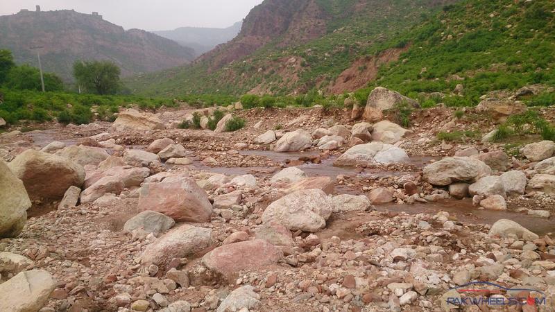
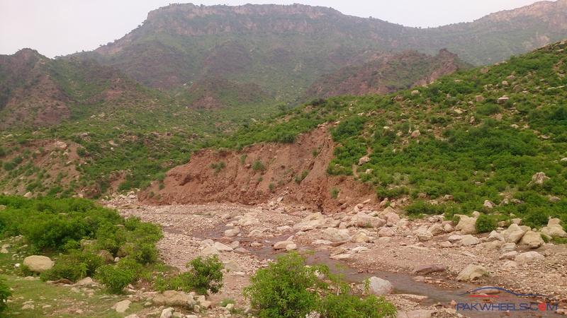
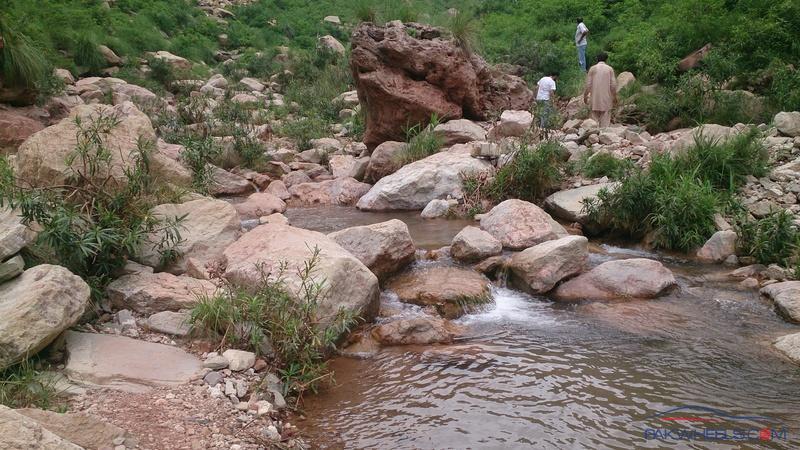
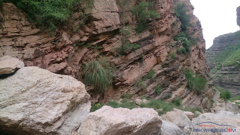
7) the trail is very simple, it goes from baghanwala village right adjacent to a small stream. you can ask any local there also, he would kindly guide you. On roaching the stream eventually, you will have cross it. It is very shallow and there are rocks so you can easily cross it. After crossing it, you trek on the back side of the mountain
8) you should have some experience in trekking or you will find it difficult to climb up the mountain. Although it is about a 150-200 meter climb it is very steep in some places,and in some places you may lose track of the trail. we managed to reach the top of the mountain in about 2 hours ( but we got very tired), we were really exhausted in several places.
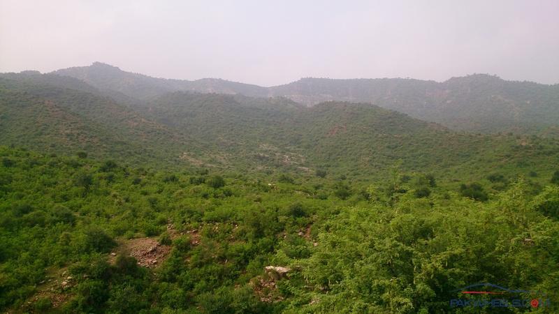
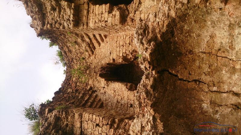
9) the view from the top is simply amazing and can't be expressed in my lame photographs i took with my mobile, Lol ( had no DSLR). I do advise people who are real explorers to go to this place. Very few people know of it but indeed it is accessible. see photos for more details.